On a recent project near the Leeds Outer Ring Road, we installed a network of in-place inclinometers and piezometers to track lateral movements and pore water pressure dissipation behind a 9 m deep excavation for a new commercial complex. The underlying coal measures sandstone and mudstone sequence, typical of the Leeds district, required careful selection of vibrating wire piezometers to capture the perched water tables that form along bedding planes. Before finalizing the array, we cross-referenced the stratigraphy with a MASW survey to map stiffness contrasts across the site and then correlated those results with a permeability test on intact core samples to refine the drainage assumptions.
Real-time pore pressure monitoring in the Coal Measures sequence of Leeds can reduce construction delays by up to 30% compared to periodic manual readings alone.
Scope of work in Leeds
Critical ground factors in Leeds
Leeds expanded rapidly during the Industrial Revolution, with many of its current commercial districts built over backfilled mill ponds, old mine shafts, and colliery spoil. The legacy of coal mining beneath the city centre means that voids can collapse decades after infilling, producing differential settlements that strain buried services and piled foundations. Without geotechnical instrumentation in place, these movements go undetected until cracking appears in superstructure elements or tilting occurs in crane rails. The 2018 collapse of a retaining wall in Holbeck, attributed to undocumented shallow workings, underscores why continuous monitoring with automated dataloggers is now a standard requirement for large developments in central Leeds.
This service complements our laboratory testing work for a complete project analysis.
Our services
Our geotechnical instrumentation service in Leeds covers the full cycle from conceptual design through to installation, calibration, and remote data retrieval. We work closely with structural engineers to embed sensors into critical elements and provide web-based dashboards that alert the project team when thresholds are exceeded.
Inclinometer and tiltmeter arrays
Vertical and horizontal inclinometer casings installed in boreholes or cast into retaining walls, with manual or automated readings to monitor lateral ground movements during and after construction.
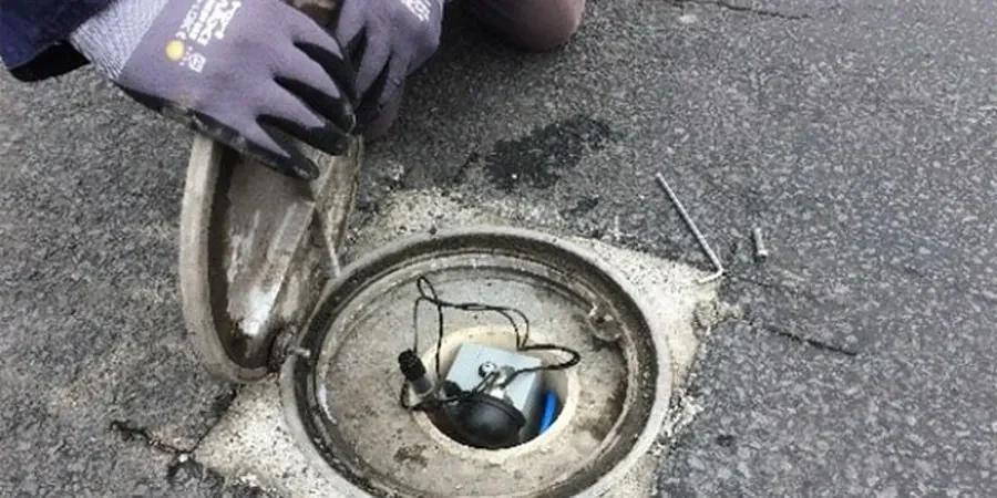
Pore pressure and water level monitoring
Vibrating wire piezometers, standpipe piezometers, and pressure transducers installed in granular or cohesive strata to track groundwater responses to excavation, dewatering, or recharge.
Load cells and strain gauges
Hydraulic and electrical resistance load cells for struts, anchors, and piles, complemented by spot-weldable strain gauges for temporary works and permanent structural health monitoring.
Settlement and heave monitoring
Precision levelling arrays, hydrostatic profile gauges, and automated total station surveys to record vertical displacements on buildings, embankments, and bridge abutments.
FAQ
What geotechnical instrumentation does my Leeds project need for an excavation adjacent to a listed building?
For deep excavations near heritage structures in Leeds, we typically recommend a combination of in-place inclinometers along the retaining wall, vibrating wire piezometers below the formation level, and automated total station monitoring on the adjacent building. The array is designed to capture both ground and structural response simultaneously, allowing trigger levels to be set before any damage occurs.
How much does geotechnical instrumentation design and installation cost in Leeds?
A typical instrumentation package for a medium-sized excavation in Leeds ranges between £2,060 and £3,580, covering sensor procurement, installation, initial calibration, and three months of remote data access. Larger projects with multiple boreholes and wireless telemetry can exceed this range, so we provide a detailed scope-based quotation after reviewing the ground conditions.
What is the typical accuracy of an in-place inclinometer system for retaining wall monitoring?
In-place inclinometers with a 2 m gauge length achieve a typical accuracy of ±0.1 mm per reading over the full depth of the casing. When readings are taken at consistent temperature and corrected for thermal drift, the cumulative error over a 20 m wall is less than 2 mm. This is sufficient to detect movement well before serviceability limits are reached under Eurocode 7.
Can geotechnical instrumentation be retrofitted to an existing building in Leeds?
Yes, we frequently install instrumentation on existing structures in Leeds. For buildings with accessible basements, we core through the ground slab to install standpipe piezometers or drive settlement markers into the foundations. For structures without basement access, we use surface-mounted tiltmeters and crack gauges, combined with borehole inclinometers installed from the external pavement. Each retrofit is designed to minimise disruption while providing reliable data.
How long does it take to install geotechnical instrumentation and start collecting data?
A typical installation for a single borehole inclinometer and two piezometers takes one to two days, including drilling, sensor placement, backfilling, and initial data validation. Wireless loggers begin transmitting readings immediately after setup, so the first set of baseline data is available within 24 hours of installation. For larger arrays spanning multiple boreholes, the mobilisation and installation phase usually takes three to five working days.